Two Tropical Depressions Threaten Land
There are now two different tropical depressions, each threatening to impact land.
The first formed last night and is located 500 miles east of the Northern Leeward Islands. The National Hurricane Center said in their 8pm advisory that the depression "is not well organized" but is still expected to become a tropical storm tomorrow.

It will move near the Leeward Islands late Friday, near the Virgin Islands and Puerto Rico Shabbos, and near Hispaniola Motzei Shabbos. The land interaction could limit additional strengthening, but as it moves away from these islands, strengthening is likely. The depression could reach hurricane strength by early next week as it moves near the Bahamas and Florida.
 |
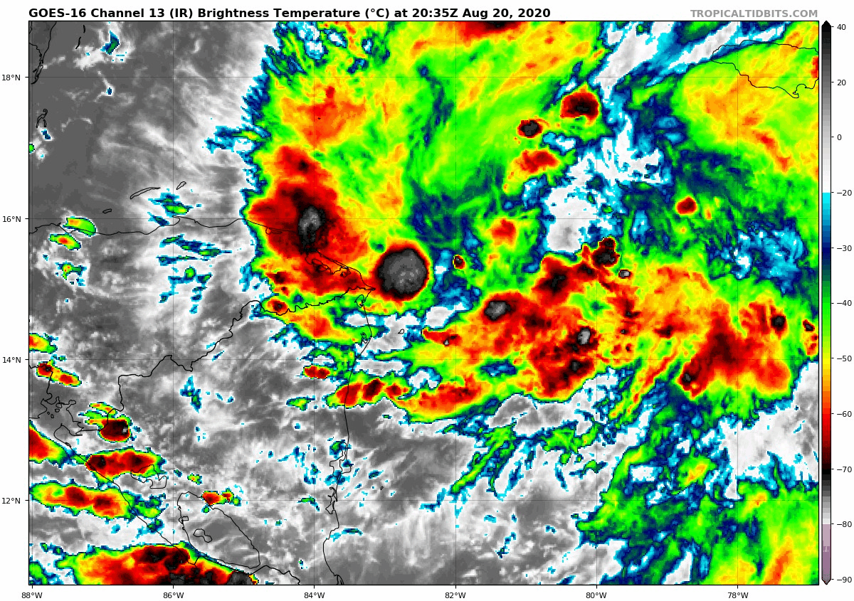
| Tropical Depression 13, IR Satellite view, 3:45pm to 9:25pm Further west, a depression is located 100 miles east of the Nicaragua/Honduras border, moving west at 17 mph. It should become a tropical storm before moving over the northern Nicaragua and Honduras. |

The tropical storm should then approach the Yucatan Peninsula in Mexico on Shabbos and Sunday, and emerge into the Gulf late Sunday. It could be near or at hurricane strength once it reaches the Yucatan Peninsula. Re-strengthening is possible over the Gulf next week.
Whichever depression becomes a tropical storm first will be called Laura, while the second will be Marco. While TD 13 formed first, 14 is better organized this evening.
These two storms will actually likely be moving over the Gulf of Mexico at the same time next week. This has only happened a couple times in recorded history, according to an article by Meteorologist Justin Berk.
A tropical wave entering the extreme eastern Atlantic tonight could become a tropical depression by the end of the weekend. Conditions will be less favorable next week.
Locally, highs will be in the mid 80s Friday under mostly sunny skies. Shabbos will also be around 85, but with a shower or two possible.
Comments
Post a Comment
Leave a comment for us here...