Strong Storms Tomorrow, Cooling
Strong storms are likely tomorrow along a stalled cold front. Heavy rains are likely, and flash flooding could occur. Therefore, the NWS has issued a flash flood watch for tomorrow afternoon and evening.


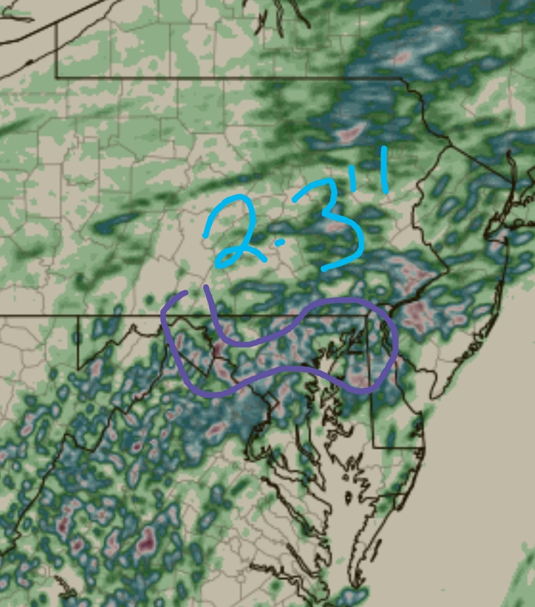
The entire green highlight area has the flash flood watch. Rain totals of 1 to 2 inches are possible, with isolated totals of 4 inches possible.
High temperatures will be around 92, similar to today.
319 PM EDT Tue Aug 11 2020
... FLASH FLOOD WATCH IN EFFECT FROM WEDNESDAY AFTERNOON THROUGH WEDNESDAY EVENING...
The National Weather Service in Sterling Virginia has issued a
* Flash Flood Watch for portions of Maryland, The District of Columbia, and Virginia, including the following areas, in Maryland, Anne Arundel, Calvert, Carroll, Central and Southeast Howard, Central and Southeast Montgomery, Charles, Frederick, Northern Baltimore, Northwest Harford, Northwest Howard, Northwest Montgomery, Prince Georges, Southeast Harford, Southern Baltimore, and St. Marys. The District of Columbia. In Virginia, Albemarle, Arlington/Falls Church/Alexandria, Augusta, Central Virginia Blue Ridge, Culpeper, Eastern Loudoun, Fairfax, Greene, King George, Madison, Nelson, Northern Fauquier, Northern Virginia Blue Ridge, Orange, Page, Prince William, Rappahannock, Rockingham, Southern Fauquier, Spotsylvania, Stafford, and Western Loudoun.
* From Wednesday afternoon through Wednesday evening
* A cold front will move into the area Wednesday and then stall out. Numerous slow moving showers and thunderstorms will pose a risk of flash flooding. Thunderstorms could produce one to two inches of rain with isolated amounts up to four inches possible.
PRECAUTIONARY/PREPAREDNESS ACTIONS...
A Flash Flood Watch means that conditions may develop that lead to flash flooding. Flash flooding is a very dangerous situation.
You should monitor later forecasts and be prepared to take action should Flash Flood Warnings be issued.
&&
$$
KJP/JE/SMZ
As a result of the cold front, highs Thursday through the weekend will be in the 80s. However, showers are possible every day.
Comments
Post a Comment
Leave a comment for us here...