What Happened To The Snow & Afternoon Update
You may be wondering what happened to all that snow we were expecting.
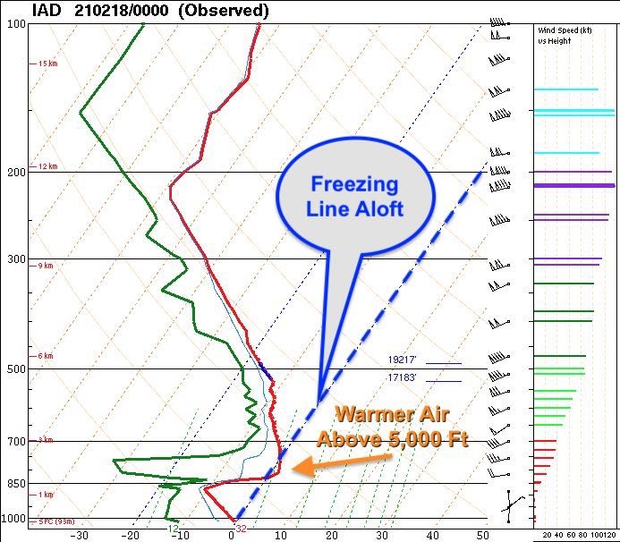

Warm air intruded on the snow party, and although it is a thin layer, it's enough to make it sleet.
"Warm air aloft has moved into the
region very quickly, albeit a very small layer that can be seen
in the 12z IAD RAOB [atmospheric observation]", the National Weather Service said this morning.
"Unfortunately for snow lovers, that
is all it really takes to change snow to sleet.
"This has drastically reduced snow totals, as the heavier rates have yet
to overcome that small warm layer, which is somewhat surprising."
This leaves a very sharp gradient, with the highest snow totals along/north of I-70 and along/west of I-81.
Some freezing rain crept into some areas, "which is rather concerning", the National Weather Service noted.
The warm layer is thin but makes the difference. As the afternoon lull has set in, don't expect much more snow today.
A coating of snow and sleet is possible tonight, with an additional glaze of ice.
So far, a coating to an inch was reported in the area.

Comments
Post a Comment
Leave a comment for us here...