Rain Ends This Afternoon, Updated Wednesday Snow Forecast
Rain will quickly exit this afternoon, between 2 and 3pm. Expect skies to begin clearing and winds to pick up towards the evening.
Tomorrow is cool, with a high near 40 and sunny.
Wednesday, it is cloudy. Precipitation should begin between 12pm and 3pm, continuing through Wednesday night.
What is that precipitation? That is the biggest question.
Forecasters and computer models are showing a sharp gradient between rain and snow.
This means that over a few miles, it can go from a foot of snow to almost zero accumulations.

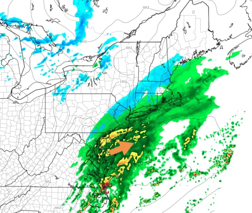
Above: precipitation moving in at 2pm.
Right now, a Winter Storm Watch is in effect for the potential for several inches of snow.
443 AM EST Mon Dec 14 2020
... WINTER STORM WATCH IN EFFECT FROM WEDNESDAY MORNING THROUGH LATE WEDNESDAY NIGHT...
* WHAT, Heavy snow possible. Total snow accumulations of greater than 7 inches possible.
* WHERE, Portions of north central and northeast Maryland and northern Virginia and the Shenandoah Valley.
* WHEN, From Wednesday morning through late Wednesday night.
* IMPACTS, Travel could be very difficult.
* ADDITIONAL DETAILS, A wintry mix could affect accumulations over portions of the watch area and result in a sharp gradient of snow totals across a small distance.
PRECAUTIONARY/PREPAREDNESS ACTIONS...
Monitor the latest forecasts for updates on this situation.
&&
$$
--
The exact line is something which may not be known until Wednesday itself.
Freezing rain is possible in that mixing zone, which would create a very dangerous hazard when driving and walking (although not the snow you may be hoping for).
We seem to be in that middle area between a lot of snow and only a little.
Here is one prediction to consider:

Our forecast:
We get snow to start (2pm-5pm), before a mix and maybe some freezing rain in the evening. Another band of heavy snow falls overnight Wednesday night, dumping 3 to 6 inches of snow.
Total snow: 6 inches
--
Highs will only be in the 30s for the remainder of the week.
Comments
Post a Comment
Leave a comment for us here...